Tropical Storm Bertha Skirts The Gulf Coast
Gulf Shores News Staff • July 21, 2026
Bertha is second named storm of the hurricane season
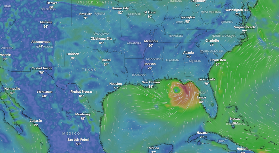
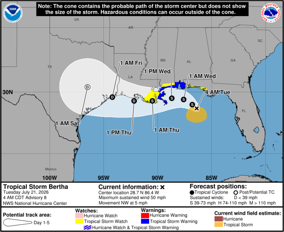
Gulf Shores, Ala. — (GSN) — Tropical Storm Bertha, the second named storm of the Atlantic hurricane season, has strengthened as it moves through the northeastern Gulf of Mexico. Formed Monday evening south of the Florida Panhandle, the storm is currently drifting slowly west-northwest at approximately 2 mph. As of early Tuesday, maximum sustained winds had increased to near 50 mph.
Forecasters expect the storm to maintain a slow motion near or along the northern Gulf Coast over the coming days as it pushes westward toward Texas.
Residents along the Gulf Coast, including the Gulf Shores and Orange Beach area, should prepare for several environmental hazards as the system progresses.
Heavy Rainfall and Flash Flooding: Widespread rainfall totals of 2 to 4 inches are expected along much of the central Gulf Coast, with isolated amounts reaching up to 8 inches in some areas. This brings a distinct risk of flash flooding through Friday.
Storm Surge: Potentially life-threatening storm surges of up to 4 feet are possible along portions of the coastline. A storm surge watch has been issued for the area stretching from the mouth of the Mississippi River to the Alabama-Florida border.
Dangerous Coastal Conditions: The impact is already visible at the shoreline. Red flags are flying on the beach at Orange Beach, Alabama, to caution swimmers about high surf and dangerous currents.
Wind and Tornadoes: While wind speeds are a concern, forecasters have also warned that Bertha could potentially spin off an isolated tornado or two, particularly in the Florida Big Bend region.
Watches and Warnings
A Tropical Storm Warning is currently in effect for a wide area stretching from the Alabama-Florida border westward to the Jefferson-Plaquemines parish line in Louisiana. Additionally, Tropical Storm Watches have been posted for other portions of the Gulf Coast, including the area from the Bay-Gulf County line in Florida westward to the Florida-Alabama border.
Residents are urged to stay informed through local weather alerts, as the situation remains dynamic and additional watches could be required. Officials recommend that those in flood-prone areas remain vigilant and follow any guidance from local emergency management regarding safety precautions, such as the use of sandbags.






















Recent Posts