Canal Road Bypass Moves Forward In City Council Work Session
R. Peevy • October 6, 2026
The new road will be a more direct route into the heart of Gulf Shores
Gulf Shores, Ala. — (GSN) — At this week's Gulf Shores City Council work session city officials presented updates on the ongoing Canal Road Reroute and Property Swap Project, detailing key steps toward securing the right-of-way for a potential future roadway. The initiative, closely tied to the planning of the local pedestrian bridge, involves multi-agency collaboration and complex land exchanges aimed at addressing long-term infrastructure needs.
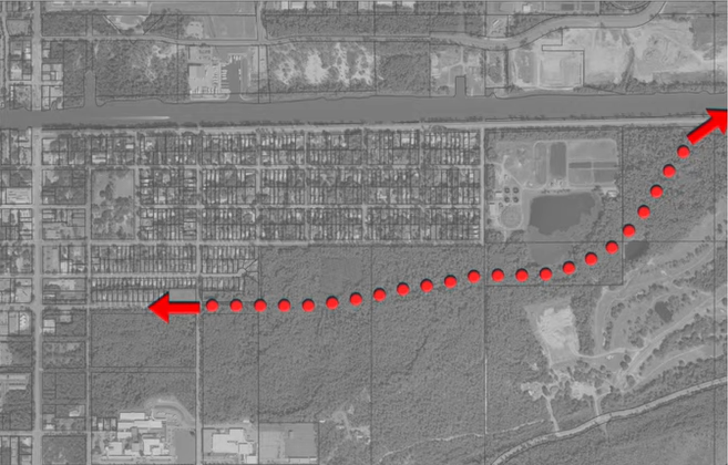
The road has been dubbed as the "Canal Road Bypass" by local residents and will provide a more direct route into the heart of Gulf Shores.
Survey Agreement and Land Exchange
A central item brought before the council was a proposed professional services agreement with Sawgrass Consulting LLC for an amount not to exceed $39,500. Sawgrass Consulting has been tasked with conducting a 360-acre boundary survey, developing a new plat, and preparing legal descriptions for the resulting parcels. The $39,500 required for these consulting services is already fully budgeted within the executive account, and authorization is being requested for the mayor to negotiate and execute the contract.
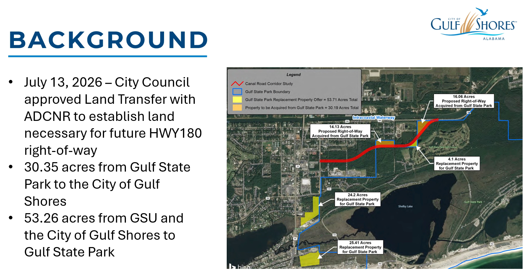
The survey work supports a major property swap that has required extensive coordination between local, state, and federal entities. Following meetings with residents who expressed a preference to reroute Canal Road away from the Gulf Pines subdivision and Meyer Park neighborhood, the city collaborated with the Alabama Department of Transportation (ALDOT) and the Department of Conservation and Natural Resources (DCNR). To facilitate the swap, the city provided approximately 53 acres of land in exchange for roughly 30 acres from the state park to secure the necessary right-of-way.
Because state park land was involved, the property exchange required state and federal oversight under the National Park Service's 6F approval process. With the assistance of DCNR legal counsel, final hurdles were cleared, enabling the council to authorize the execution of deeds earlier in the summer. Gulf Shores Utilities (GSU) also participated in the land exchange, relinquishing property near its wastewater treatment center on Canal Road and 10th Street. In turn, staff proposes gifting a section of land back to GSU as a contribution toward the overall right-of-way project, a request that will formally come before the council following completion of the survey work.
Long-Term Infrastructure and Roadway Vision
The reroute plan aligns with the city's Major Street Plan adopted in 2019. The temporary route through the Gulf Pines subdivision was implemented during the construction of the Waterway Village and pedestrian bridge to divert traffic from residential streets. While the city is actively securing the right-of-way, officials clarified that there is currently no budget, allocated funding, or immediate timeline to construct the new roadway.
The overarching goal for the proposed roadway is to establish a permanent alternative route that can function as an evacuation corridor or a primary daily exit from the island, relieving pressure on Highway 59. Although the project faces challenges regarding wetlands within the state park, city leadership emphasized that securing the right-of-way now ensures readiness when traffic demand warrants state funding and construction. Decreased traffic on Highway 180 following the opening of the new Intracoastal Waterway bridge continues to be monitored as officials evaluate long-term traffic patterns and maintain ongoing discussions with state leaders regarding future infrastructure investments.







Recent Posts